

An analysis of the Chinese reconnaissance satellites, and their maritime surveillance capabilities
This article initially appeared on eastpendulum.com, a French-language blog about the Chinese military and aerospace industry
Historical context
Ever since the Communist Party conquered mainland China in 1949, the island of Taiwan has been a source of tension in the region. The defeated Republic of China (RoC) government fled to this province, and has survived mostly thanks to the 100-mile Taiwan strait that separates it from the People’s Republic of China (PRC), and thanks to the military support of the United States. The last major crisis between the two Chinas took place in 1996: after the Taiwanese president visited the USA, the PRC organized large and intimidating military exercises. Eventually, the USA sent two carrier battle groups in the region, forcing the PRC to stand down. In reaction, the PRC launched several new weapons program, in order to deter the Americans from intervening again.
One of the main objectives of these programs is to be able to credibly threaten a US aircraft carrier. In addition to being extremely well defended, the carriers and their attached battle groups are also very mobile. Locating them is a difficult task, as a ship going 20 knots can cross 500 nautical miles (800km) a day. The first step of a carrier hunt is consequently a high-stakes game of hide and seek.
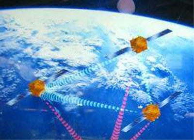
One of the ways the Chinese tried to solve this problem was to develop a space-based maritime surveillance system, with electronic intelligence, radar and optical satellite constellations. The aim of this article is to give a survey of these constellations, and to assess how much their combined capabilities give China an accurate and comprehensive picture of the situation at sea.
I. The electronic intelligence system
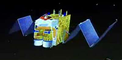
JianBing 8 constellation
Satellites: Yaogan 9, 16, 17, 20, 25, 31-01 -02 -03 -04
Type: ELINT
Orbit: 1100x1100km, 63°
This constellation is made up of 3 orbital planes, all inclined 63°. Each plane contains one or two triplets of satellites flying in close formation. Theses characteristics are very much like those of the US NOSS/INTRUDER constellation, which is dedicated to detecting, identifying and locating radars and telecommunication emitters, including those carried by warships. The JB-8 constellation most likely fills the same role.
Consequently, the satellites can only detect ships which are not under radio silence, as is often the case during crisis situations. Ships can also avoid detection by turning off their radar when the satellites are overhead (roughly 20 minutes every hour and a half). However, these satellites might also detect the radars carried by carrier-launched early warning planes, giving a rough location for the carrier itself.
Some sources mention that each triplet also carries optical and radar sensor. If it is the case, these sensors probably provide limited coverage: the 3 satellites of a triplet fly close, so the sensors they carry have the same viewing angle constraints. Besides, it would seem more logical to take the time to analyze the data from this system, and then task other satellites later, to get more data on interesting detections.
8 triplets have been launched, with the last 3 expanding the constellation beyond the initial 3 orbital planes:
| Satellite | Local time of passage | Launch year | Comments |
|
YG 9 a/b/c |
Variable, as the orbit is not sun-synchronous |
2010 |
|
|
YG 16 a/b/c |
same |
2012 |
|
|
YG 17 a/b/c |
same |
2013 |
|
|
YG 20 a/b/c |
same |
2014 |
Probably replaces YG 9 |
| YG 25 a/b/c |
same |
2014 |
Probably replaces YG 16 |
|
YG 31 a/b/c |
same |
2018 |
Probably replaces YG 17 |
|
YG 31-02 a/b/c |
same |
2021 |
New plane |
|
YG 31-03 a/b/c |
same |
2021 |
New plane |
|
YG 31-04 a/b/c |
same |
2021 |
New plane |
|
YG 34 |
same |
2021 |
Optical satellite, coorbital with YG-31-02 and a few minutes behind it |
With the launch of group 31-04, there are now 6 regularly-spaced orbital planes, so the constellation is likely complete:

The Yaogan-30 constellation
Satellites: Yaogan-30-01 A/B/C, Yaogan-30-02 A/B/C, Yaogan-30-03 A/B/C, Yaogan-30-04 A/B/C, Yaogan-30-05 A/B/C
Type: probably ELINT
Orbit: 600x600km, 35° inclination

It is a fast-revisit constellation, with the first satellites launched in 2017. It is probably an ELINT constellation. I dedicated separate articles to it.
GEO ELINT
Satellites: TJS-4 and maybe TJS-1
Type: probably ELINT
Orbit: Geostationary, at 155°E for TJS-1 and 83.5°E for TJS-4
TJS-4 is an “experimental communication satellite”. The images published during launch show it carrying a large foldable antenna, and ultra wideband log-periodic antennas. The solar panels are also small for a communication satellite, which requires a lot of power, and are similar to the ones of the early warning TJS-2 satellite.

These features make it very similar to the American geostationary SIGINT satellites. So it’s highly likely TJS-4 serves the same purpose. The TJS-1 satellite launched in 2015 with the same official description and also reportedly carrying a large mesh antenna is probably also a GEO SIGINT bird.
II. The radar system
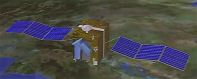
JianBing 7 constellation
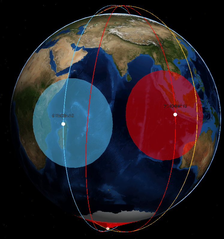
Satellites: Yaogan 6, 13, 18, 23
Type: SAR
Orbit: polar sun-synchronous, 520x520km
Synthetic Aperture Radar (SAR) satellites are very useful in maritime surveillance, thanks to their wide swath, which can reach several hundred kilometers. This enables them to find ships, given a very rough idea of where they might be, in any weather. However, the wide swaths modes of such a system generally have a low resolution, measured in the tens of meters. This makes ship identification difficult. Consequently, a higher-resolution system, or another pass of the same satellite but in high-resolution mode, are needed. Ship motion can severely limit the image quality in high-resolution modes.
For ground observation, the high-resolution modes are often used, as the location to be imaged is generally known in advance.
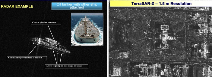
Unlike classical optical satellites, radar systems can be used at night, and consequently can provide images more often.
The constellation is made up of the following satellites:
| Satellite | Local time of passage | Launch year | Comments |
| YG 6 | 9:40 | 2009 | |
| YG 13 | 12:40 | 2011 | |
| YG 18 | 10:00 | 2013 | Probably replaces YG 6 |
| YG 23 | 13:20 | 2014 | Probably replaces YG 13 |
The satellites fly in pairs, with one pair providing morning passes and the other afternoon passes. Each pair is made up of one relatively recent and an older satellite, which may be out of service. If all four satellites were active, it would provide each day one morning revisit, one during the afternoon, and two at night, with a maximum viewing angle around 45°. Since the orbits are sun-synchronous, the same satellite always passes over a given point in the ground at the same local time. The times indicated in the table above are for places located at the equator; for other places the time is shifted by a few minutes.
According to the image above, YG-13 looks like Gaofen-3, a Chinese civilian satellite which was launched in 2016. To give an idea of the performance of Chinese SAR technology, Gaofen-3 has a maximum resolution of 1m and a maximum swath width of 650km, from a 730x730km orbit. Even a pair of such satellites would not be sufficient to cover all the oceans’ surface every day, but would be enough to find all ships in a relatively wide region of interest.
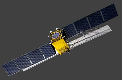
JianBing 5 constellation
Satellites: Yaogan 1, 3, 10, 29
Type: SAR
Orbit: Dawn-dusk polar sun-synchronous, 620x620km

This constellation is also a SAR constellation, but its satellites fly higher and pass during dawn and dusk. That way, their solar panels are always lit and they have more electrical power.
The constellation is probably made up of only two active satellites:
| Satellite | Local time of passage | Launch year | Comments |
| YG 1 | 6:00 | 2006 | |
| YG 3 | 5:20 | 2007 | |
| YG 10 | 5:20 | 2010 | Probably replaces YG 1 or 3 |
| YG 29 | 4:40 | 2015 | Probably replaces YG 1 or 3, with a newer design |
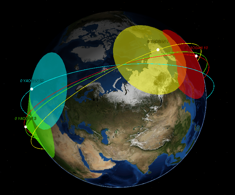
With two active satellites, this constellation would provide a morning revisit and an evening revisit every day, with a maximum viewing angle around 45°.
III. The optical system
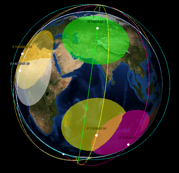
JianBing 6 constellation
Satellites: Yaogan 2, 4, 7, 11, 24, 30
Type: Optical
Orbit: Polar sun-synchronous, 630x630km
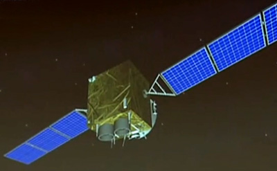
This optical constellation is probably made up of two or three active satellites. They are positioned on a classical orbit for such a system, and provide morning and afternoon revisits.
If the images shown by the Chinese state television are to be trusted, these satellites carry two cameras, probably to widen their swath. This solution is also used on the civilian Chinese satellites Gaofen 1 (2m resolution, 69km swath) and 2 (0.8m resolution, 45km swath). It is typical of Chinese satellites, as their 1m resolution or better foreign counterparts usually carry only one telescope. A dual camera system can also be used to acquire stereoscopic images, in order to build terrain elevation models. In that case the swath is the same as a single-camera system.
These satellites do not seem to have a wide enough swath to be useful for maritime surveillance anyway: a 70km swath is very small compared to the area of that has to be covered to detect ships in the open ocean. Even to identify ships which have already been located, such a swath width means a ships going 30 knots can get out of the field of view in around 40 minutes. Consequently these satellites can only be used to image ships if they have been located very recently.
| Satellite | Local time of passage | Launch year | Comments |
| YG 2 | 12:40 | 2007 | |
| YG 4 | 6:00 | 2008 | Pass time is too early for an optical satellite, so probably out of service |
| YG 7 | 15:40 | 2009 | |
| YG 11 | 9:00 | 2010 | |
| YG 24 | 13:00 | 2014 | Probably replaces YG 2, with a newer design |
| YG 30 | 9:00 | 2016 | Probably replaces YG 11, with a newer design |
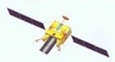
JianBing 10 constellation
Satellites: Yaogan 5, 12, 21
Type: Optical
Orbit: Polar sun-synchronous, 500x500km
This second optical constellation is placed on a lower orbit, and provides only morning passes. Thus, it probably has a higher resolution than JB-6. On the image above, a dual-camera system can be seen, along with a data-relay antenna (the red dish pointing upwards). The relay system uses the 3 geostationary Tianlian satellites, and is probably used by all Chinese reconnaissance satellites.
These satellites probably have the same limitations for maritime surveillance as the JB-6 ones.
| Satellite | Local time of passage | Launch year | Comments |
| YG 5 | Deorbited | 2008 | |
| YG 12 | 10:00 | 2011 | |
| YG 21 | 10:30 | 2014 |
JianBing 11 (?) constellation
Satellites: Yaogan 14, 28
Type: optical
Orbit: Polar sun-synchronous, 500x500km
This constellation seems to be the afternoon equivalent of JB-10. The JB-11 designation is speculative.
| Satellite | Local time of passage | Launch year | Comments |
| YG 14 | 14:00 | 2012 | |
| YG 28 | 14:00 | 2015 |
JianBing 12 (?) constellation
Satellites: Yaogan 26
Type: Optical
Orbit: Polar sun-synchronous, 500x500km
This satellite is placed on the same orbit as the JB-10 constellation, but could be of a different model. According to the picture above, it carries a single large-diameter telescope. The Changchun Institute of Optics is known to work on such 1.3 to 1.6m telescopes, which provide a 20 to 25cm ground sampling distance if carried by Yaogan 26. Such a high resolution would be traded against swath width, making the satellite less useful for maritime surveillance. The JB-12 designation is also speculative.
| Satellite | Local time of passage | Launch year | Comments |
| YG 26 | 11:00 | 2014 |
Gaofen 11
Satellites: Gaofen 11 and 11-02
Type: Optical
Orbit: Polar sun-synchronous, 490x490km
Gaofen 11 and 11-02 are exceptional satellites, being the closest thing China has to the large American optical spy satellites, with a resolution of 10cm when they are in a 247x693km elliptical orbit. They later move to a circular orbit but the resolution remains impressive due to the large mirror. Here is a more detailed article on the subject.
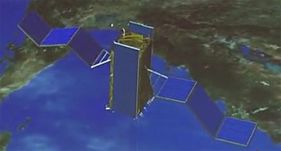
JianBing 9 constellation
Satellites: Yaogan 8, 15, 19, 22, 27
Type: Optical
Orbit: Polar sun-synchronous, 1200x1200km


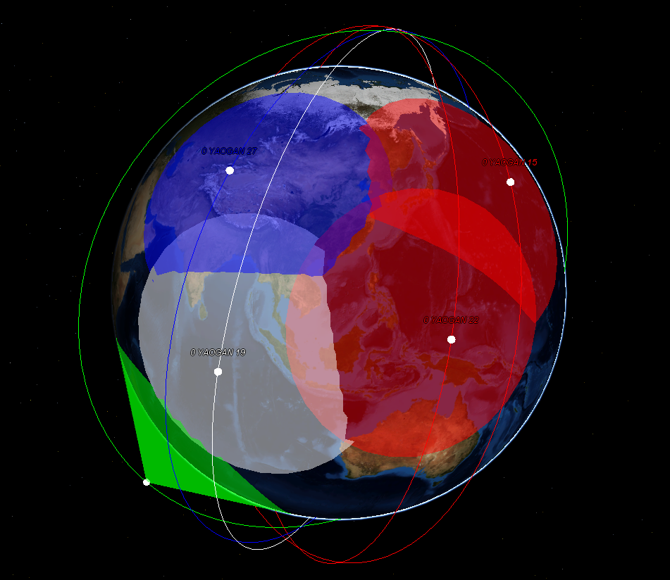
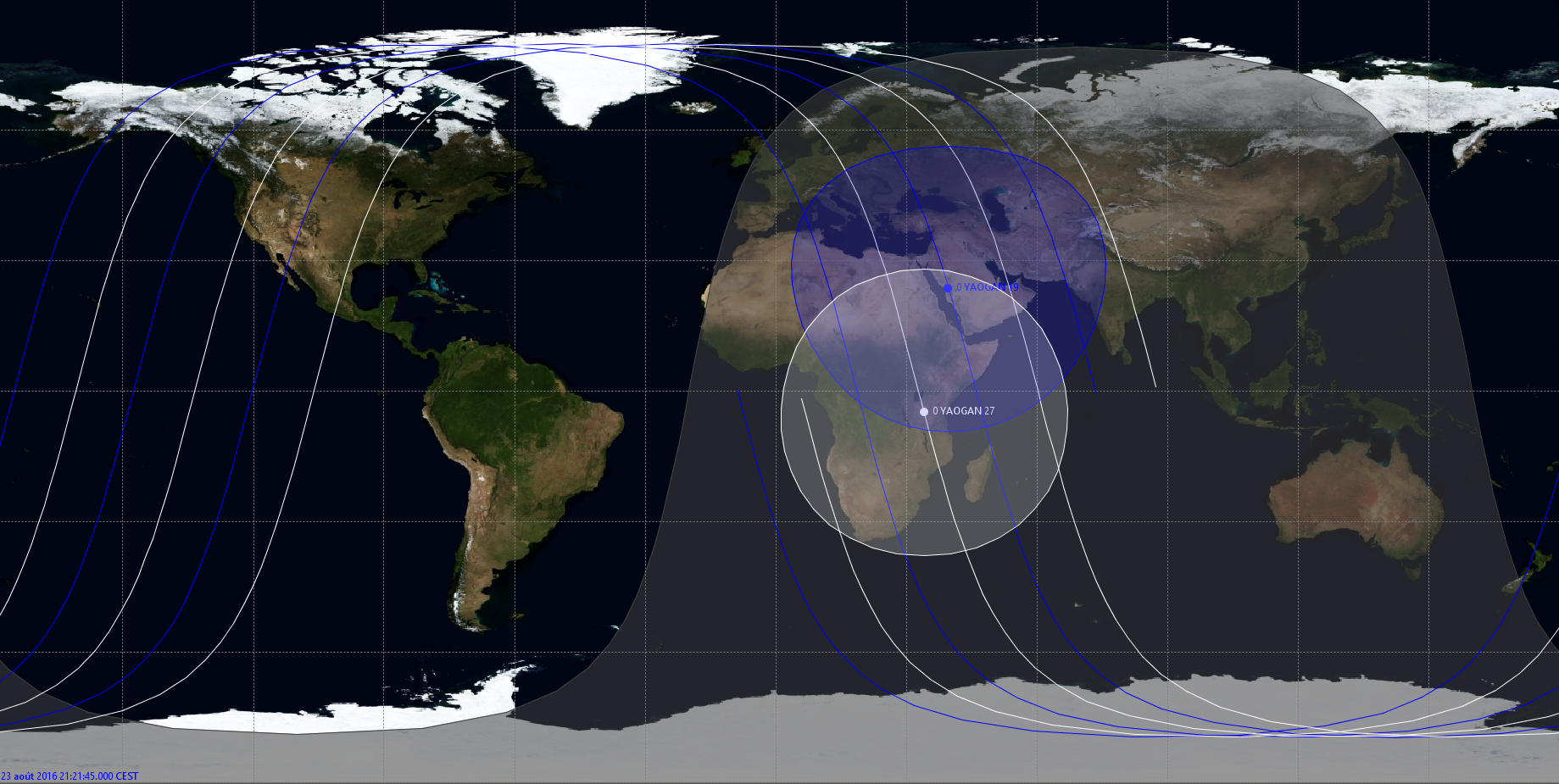
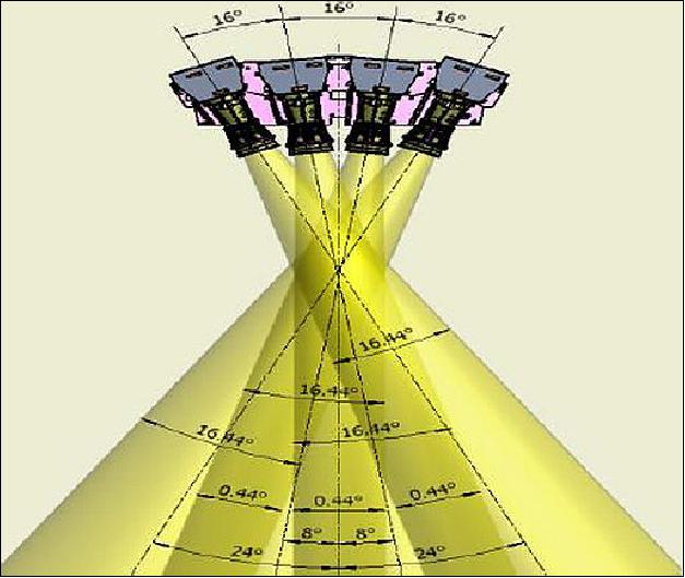
This constellation is placed on a surprisingly high orbit for optical satellites. Because of this height, the spatial resolution is lowered but the swath is increased. The constellation is made up of a first pair of satellites, which provides morning passes, and a second pair for afternoon passes. This enables same-day revisit of any point a the globe, with a small viewing angle (around 25°). It also makes extremely short revisit times possible: the two satellites of a pair follow each other, with a separation of 10 minutes. Thus, they can successively observe the same region with an acceptable maximum viewing angle (around 45°) and estimate the speed of ships in this region.
According to a biography of Chinese scientist Ren Jianyue, this constellation is dedicated to maritime surveillance, and combines a wide swath and a high resolution. The satellites carry an off-axis Cook-TMA telescope, made out of silicon carbide, and are able to identify ships thanks to a wide swath (between 100 and 1000km) and a high resolution( <10m). According to the NIIRS scale, ship identification requires at least a 4.5m resolution. Other sources indicate precise classification requires 0.8m. JB-9 probably has a performance between those two figures.
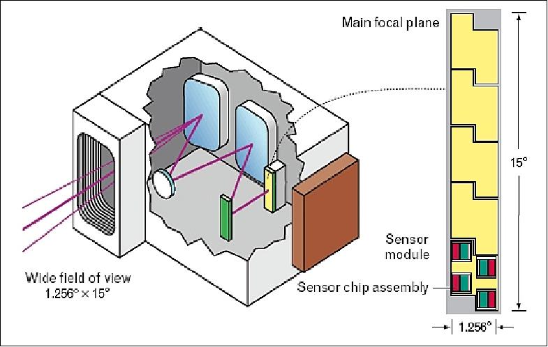
The Cook-TMA telescope design has been used by NASA for the EO-1 satellite: it offers a 15° field of view, which translates into a 185km swath from a 700km altitude. This would be coherent with the JB-9 pictures above: a field of view around 20° would explain the angled baffles. Such an instrument would give the JB-9 satellites a swath width around 320km, which is comparable to a SAR satellite, but with a much better resolution.
The swath could possibly be even wider if the satellites are agile enough to be repointed quickly. For instance, very agile satellites such as Spot 6 can be repointed to image a square region 6 times wider than their swath, in a single pass. JB-9 agility is probably lower, as evidenced by their large solar panels, but it’s not impossible they could double their swath by repointing.
| Satellite | Local time of passage | Launch year | Comments |
| YG 8 | 7:40 | 2009 | Time of passage is early for an optical satellite, so may be out of service |
| YG 27 | 09:40 | 2015 | |
| YG 19 | 10:20 | 2013 | |
| YG 22 | 13:00 | 2014 | |
| YG 15 | 14:00 | 2012 |
These satellites might also carry a thermal infrared sensor, enabling them to detect and maybe identify ships at night. Another possibility is that they also have a low resolution but ultra-wide swath camera, like the one used by the Gaofen-1 civilian satellite. Such a camera would have a swath of 1550 km and a resolution of 30m from a 1200km altitude, enough to cover all the oceans with two satellites and detect large ships such a oil tankers and aircraft carriers.

According to public pictures, the civilian Gaofen-8 satellite looks like a JB-9 satellite, but it flies much lower, at an altitude of 500km.
Gaofen 4
Type: Optical
Orbit: Geostationary, 105°E


Gaofen 4 is a one-of-its-kind satellite: launched in 2015, it is the only high-resolution imaging satellite to be placed in geostationary orbit. With its 50m resolution, it provides images 10 times sharper than the weather satellites on the same orbit. Since it is stationary in the sky, and is always placed 36 000 km above Singapore, it can revisit a place extremely frequently, and it can even produce video sequences, to make change detection easier. It has a 400km field of view, and it can image any region in the East Asia at any time. It also has an infrared sensor with 400m resolution, to take pictures at night.
These features enable the satellite to detect and track large ships, and probably to determine their type based on their speed, their heading and their thermal signature. Detecting smaller ships light also be possible.
Gaofen 13
Type: Optical
Orbit: Geostationary, 118°E

Gaofen 13 is the latest optical GEO satellite, launched in 2020, and has an even bigger mirror than Gaofen-4: based on the launch photos it has a diameter of 1.7m. This is the same diameter as Gaofen 11 so they might share a common mirror. This gives it a resolution of 15m, which is probably enough to track aircrafts moving around an airport, which could be useful for targeting. This resolution is also probably enough to accurately measure the length of a ship and thus identify it, making it useful for maritime surveillance too.
Mystery objects
Some other Chinese satellites seem to be in sun-synchronous orbit, suggesting Earth observation satellites and have suspiciously little information about them. This is the case of the SJ-11 satellites, a constellation in a 98°, 700km orbit with many planes spread around the globe. 8 satellites were launched between 2009 and 2014. The older SJ-6 constellation also operated in a similar orbit, but with all planes in dawn-dusk orbits .


There is also the strange Yaogan 32A/32B pair. The two satellites are formation-flying very close to each other, as would be expected of a ELINT emitter-locating duet: the latest NOSS have also changed from triplets to duets. The Chinese media also described them as “electromagnetic environment” research satellites, an euphemism for ELINT. However, this pairs flies a 700km, 98° circular orbit with a 9h30 local time of the descending node, also suggesting an optical satellite.

Finally, there is the SJ-16 A/B pair, with operate in an unusual 610km x 75° orbit. The satellites also have an unusual look. They might be ELINT or maybe radar satellites.

IV. Assessment of the overall system
Maritime surveillance can be split into two separate tasks:
- Detecting and identifying all ship in a wide area
- Tracking specific ships over time, once they have been identified
In order to assess the capabilities of the Chinese maritime surveillance system, let’s take conservative hypotheses:
- During a crisis, warships are under strict emission control, which makes the electronic intelligence system blind.
- Each SAR constellation has only two active satellites.
- SAR satellites have a 300km swath, and not enough resolution to identify ships.
- Apart from the JB-9 constellation, the low Earth orbit optical satellites do not have a large enough swath to be useful for maritime surveillance.
- The JB-9 constellation has 4 active satellites, with a 300km swath and no infrared capability.
- The satellites can only image 10 minutes per orbit, which means the maximum swath length is 4000km.
- The geostationary Gaofen-4 satellite cannot detect ships smaller than an aircraft carrier.
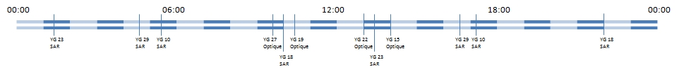
With these hypotheses, there are 12 satellite passes a day for a given location:
Detection and identification
The performance of the constellation regarding the detection of all ships in a large area depends on the combined swath of all its satellites, compared to the distance between two satellite passes. For instance, if the constellation had only one satellite with a 3000km swath, and if the distance between two successive passes at the equator were also 3000km (which is typical for a low Earth orbit satellite), then it would be able to cover all of Earth’s surface each day.
With the hypotheses above, the combined swath is 300km x 12 = 3600km. The system can consequently provide full coverage over a 3000km x 4000km area, each day, and detect all ships in this area. However, since only the JB-9 constellation can identify ships, identification can be performed in third of the area.
Tracking
In order to optimally track a ship which has been identified beforehand, the satellite passes have to be spread out at regular intervals during the day. This is not the case: two successive passes can be up to 4h40 apart (for YG 10 and YG 18 in the evening). This is enough for a ship going at 30 knots to cross 250km, which can result in it getting out of the field of view of the tracking satellite.
Besides, as SAR satellites fly relatively low, only half of them have a low enough viewing angle to image a given location on a given day, so only four SAR passes each day can be used to track a specific ship. Consequently, a ship which changes course regularly has a good chance of making the constellation lose its track from time to time. This would force the constellation to go back to search mode to reacquire the track.
However, around 10:00 and 13:30 local time, the pass of a pair of JB-9 satellites can provide the location, heading and speed of a ship, and confirm it identification. This is enough to establish a solid track, which could be used as a firing solution for the Chinese Anti-Ship Ballistic Missiles, or for more conventional missiles fired by planes or ships close to the target.
Conclusion
Thanks to its satellites, China has optical, radar and electronic capabilities to detect, identify and track ships at sea. Even without taking into account real-time tracking from geostationary orbit, the wide-angle JB-9 constellation and the JB-5 and JB-7 SAR constellations can find contacts in a vast area every day, and have a good chance of refreshing the location of the most interesting ships every few hours. Consequently, it seems unlikely a naval group could hide in the ocean for long.
However, when the weather is very cloudy, only the SAR satellites are able to look through, which severely limits the capabilities of the system. This does not mean China is blind: other means of detection, such as it trans-horizon radars, or its long range patrol aircrafts can complement the satellite system, and help challenge the defenses of US aircraft carriers. This makes a US intervention in a new Taiwan Strait crisis much more risky, and consequently less likely.
Sources
In Chinese:
Article on maritime reconnaissance in the Jianchuanzhishi journal
Biography of Chinese academic Ren Jianyue
Overview of the activities of the Changchun Institute of Optics
Gaofen-4’s ship tracking capabilities
In English:
Eoportal Page on the EO-1 satellite
Eoportal Page on the Gaofen-1 satellite

[…] launches, not much is known about the Yaogan-30 satellites, which are a new addition to the Chinese reconnaissance system. On September 29, 2017, a first trio was launched in a similar orbit, under the designation […]
LikeLike
It was fun reading this article and quite full of knowledge i must say. keep up the good work. Thumbs up for you mate
LikeLike
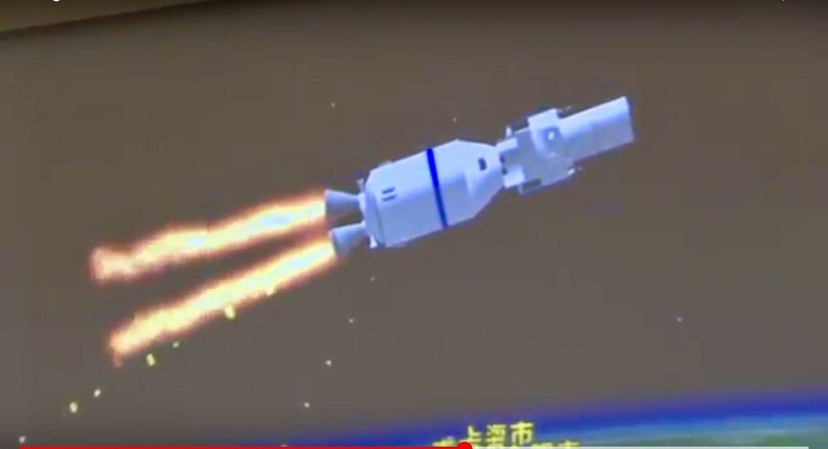
[…] not censored by the CCTV state television. They even showed those models with some of the military Yaogan satellites, probably as a form of strategic signaling towards their competitors. That way they can show the […]
LikeLike
[…] be targeted towards the Pacific, around the second island chain. It would then complement the Chinese maritime surveillance system that grows larger every year. And even more importantly, it will bring China closer to military and […]
LikeLike
So a few well placed SM-3 missiles can blind the CCP. This is not a deterrent, this is wishful thinking. Those that believe that an Aircraft Carrier is necessary to thwart a CCP invasion of a sovereign nation, most likely will not be the ones leading that invasion.
LikeLike
[…] Yaogan serija apima sintetinės apertūros radarų (SAR), elektrinių signalų žvalgybos, elektroninės optinės […]
LikeLike